This is one of those ruin sites on Comb Ridge that isn’t documented with the hiking software I use. There was no listed trail. We found information that gave us the indication that these ruins were here. We found the closest parking places to the comb and hiked in based on GPS destination. Not a path!
I will not be sharing the location, although we know others have found it like us. I will say that it is one of our longest hikes into the Comb.
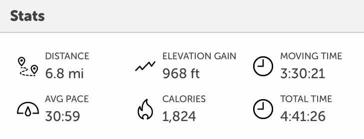
Round trip hike distance was 6.8 miles.
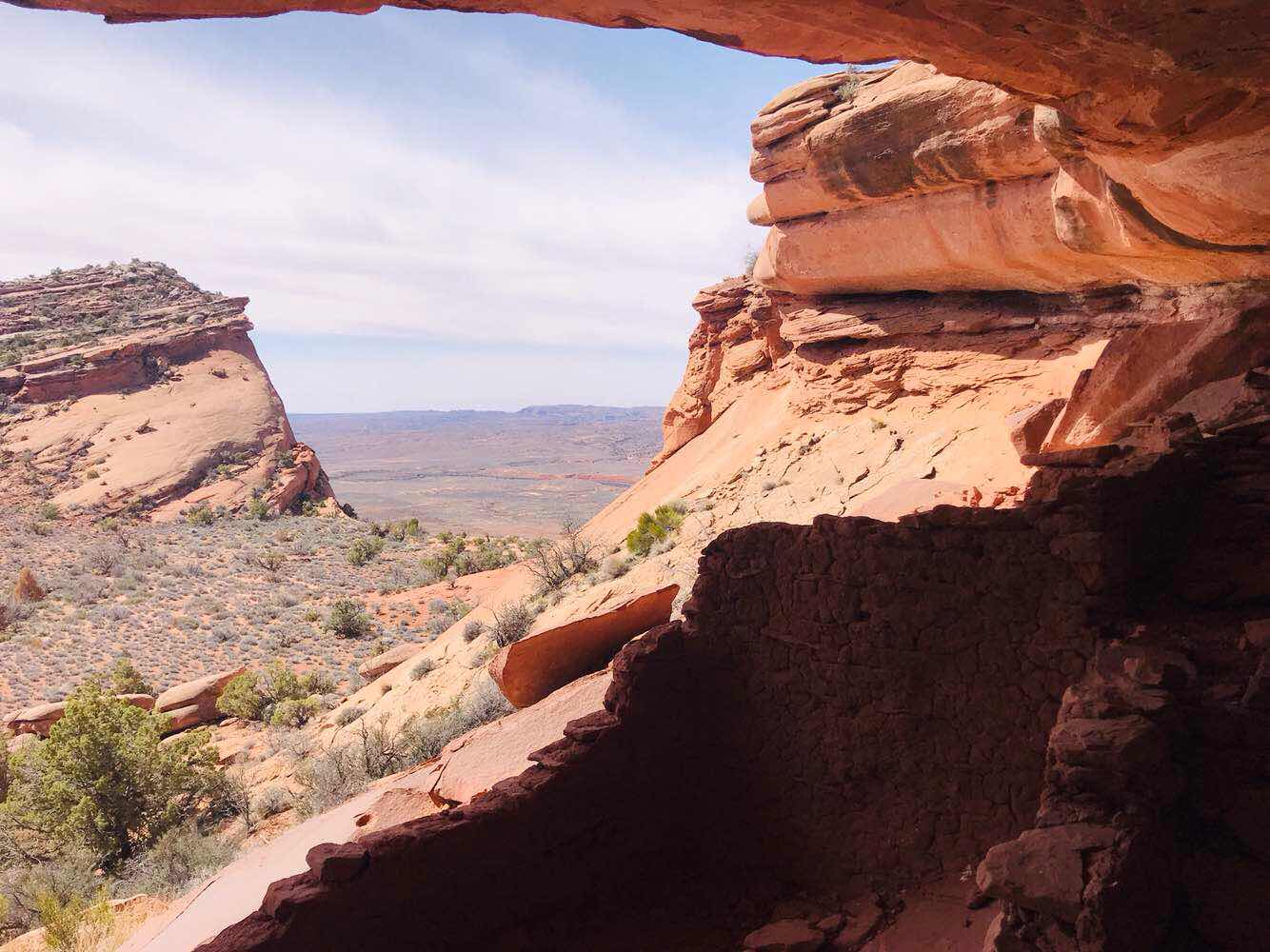
This is the view to the west from the cave.
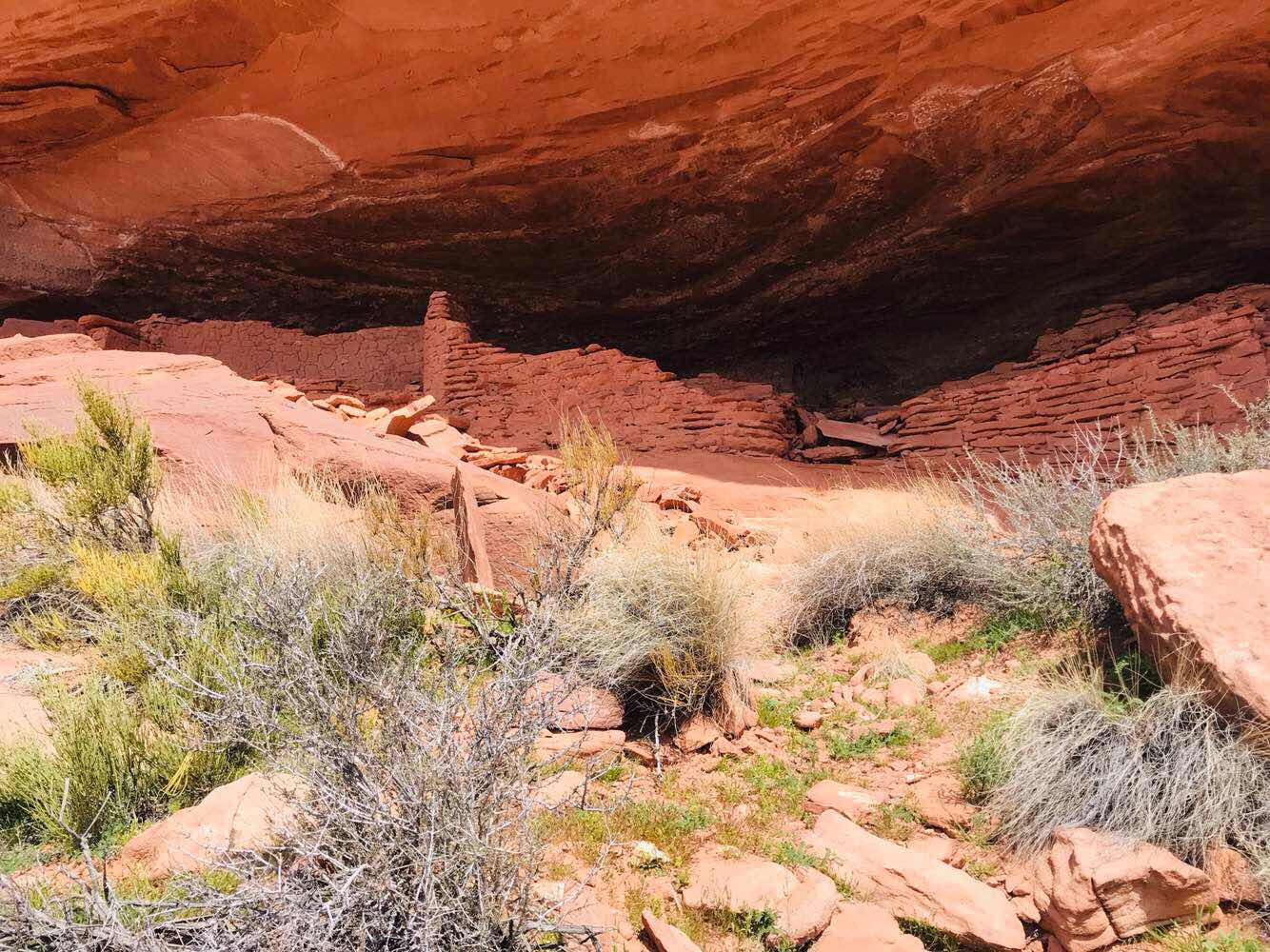
There are the ruins.
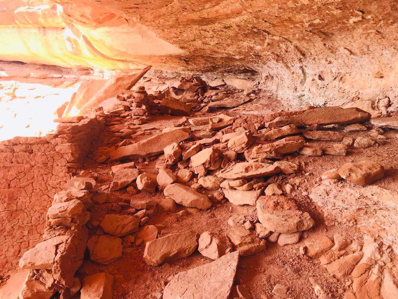
Inside, like most ruins are loose stone buildings. Some places use mud but this location is devoid of a reasonable water source nearby.
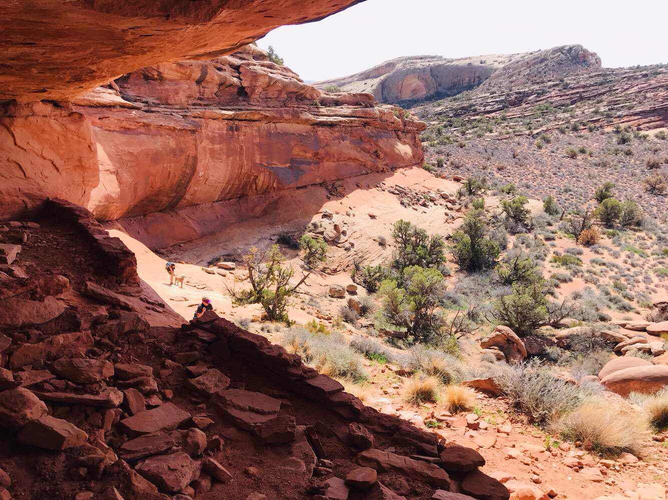
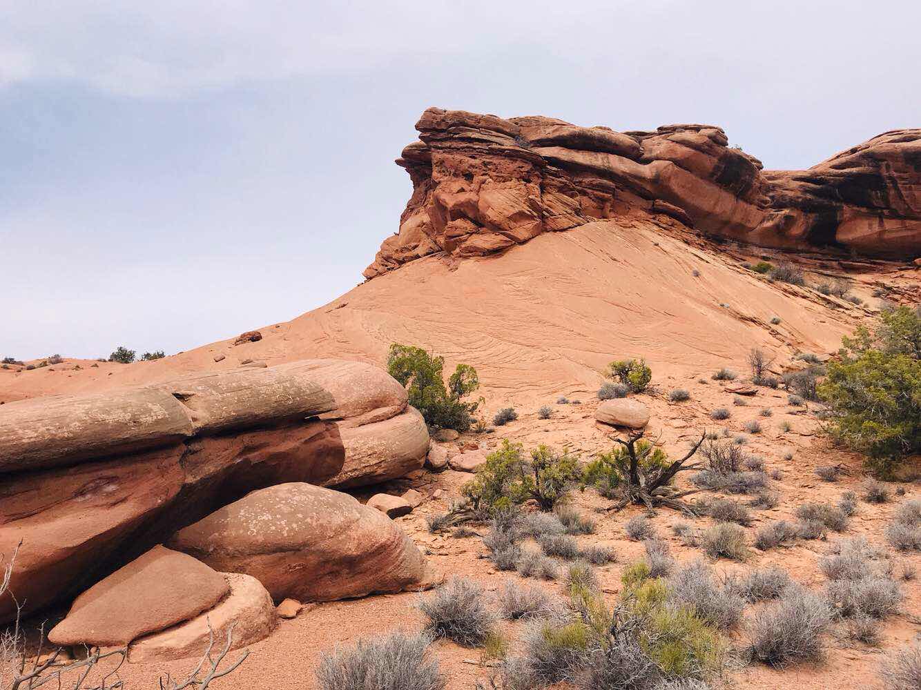
This is the view to the east.
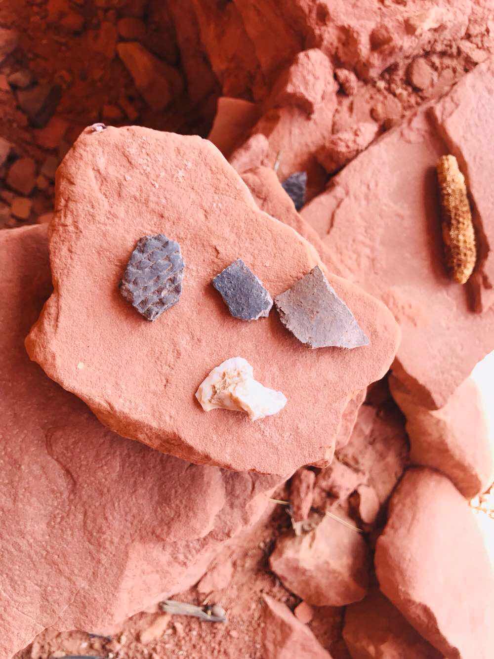
Because this site is not visited by many people there are a lot of pottery chards to look at. Noticevthe pattern on the pottery chard.
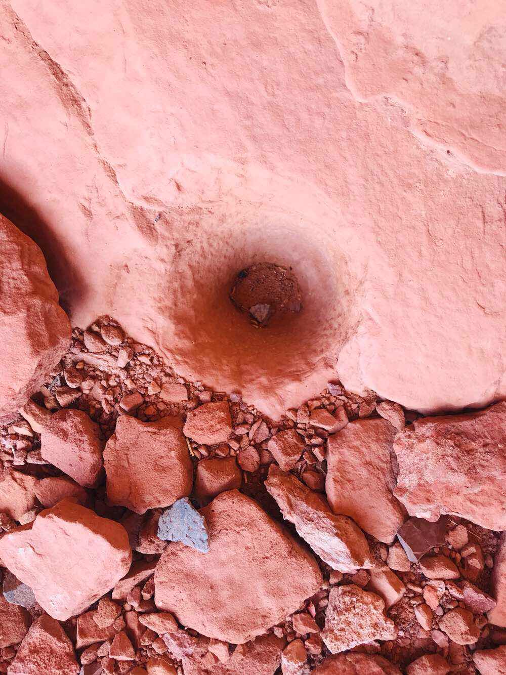
This is a grinding hole like we have seen only a few times.
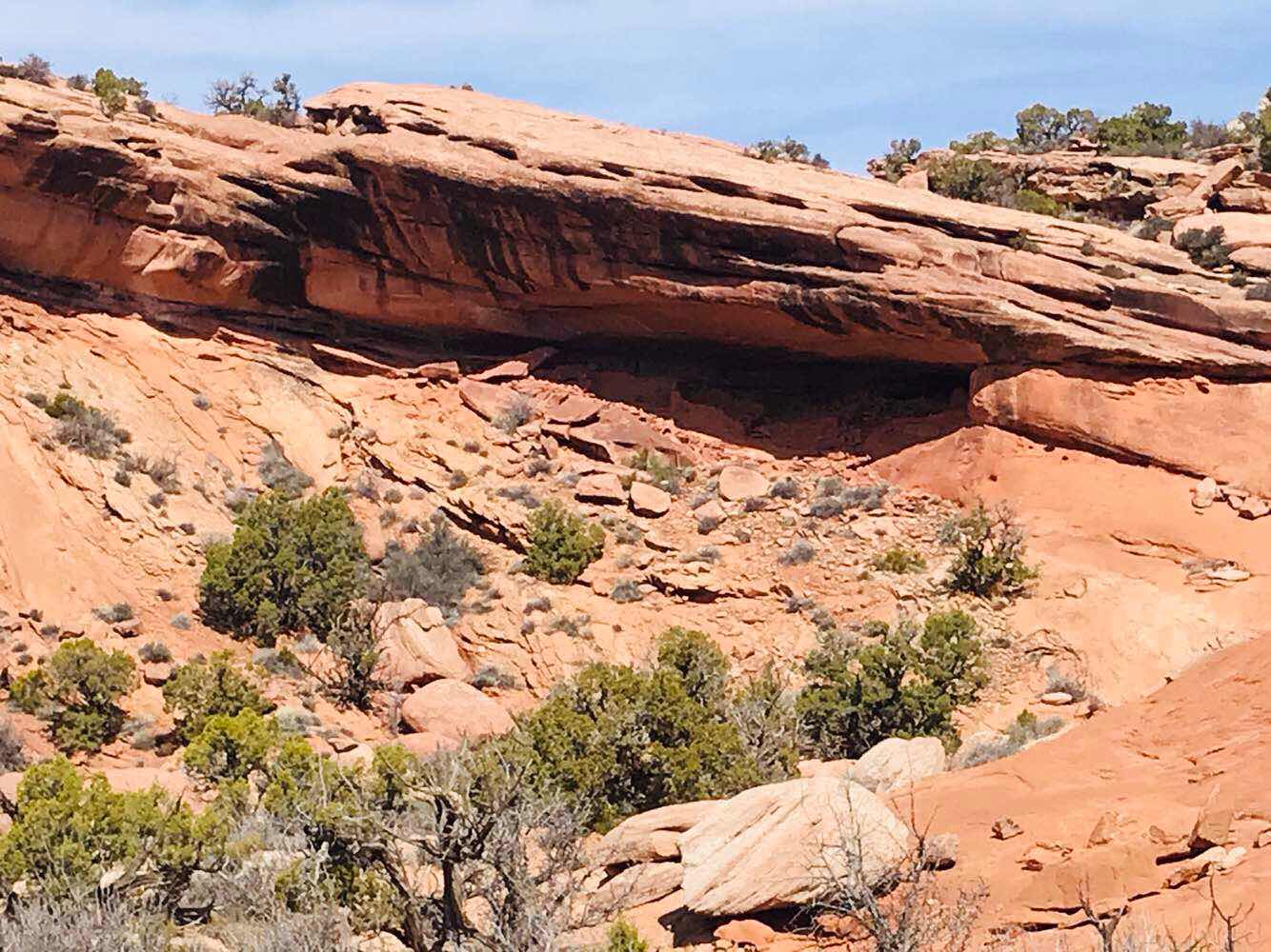
This is the scenery I the area.
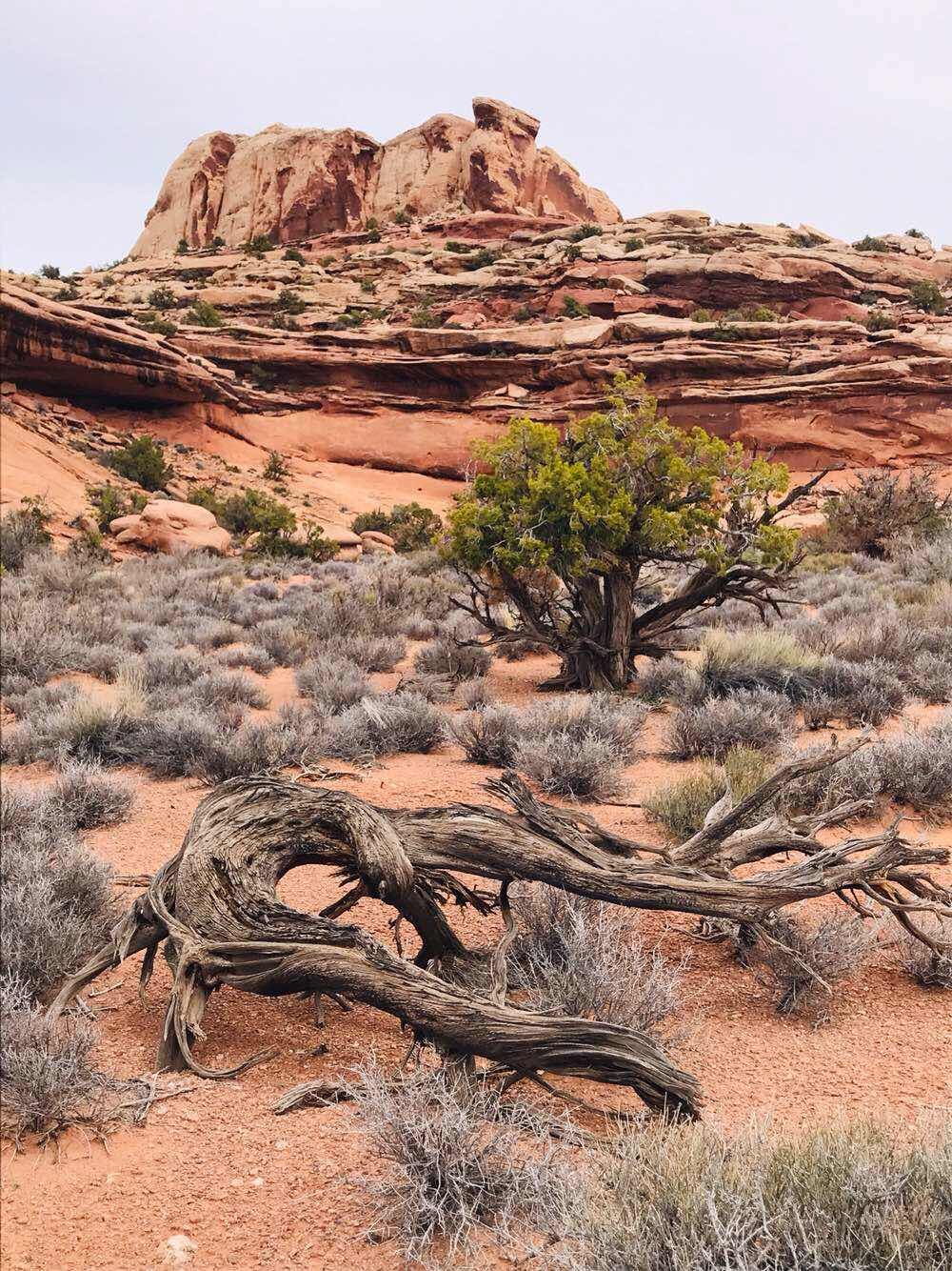
Above is from the land in front of the cave, with the trees adding to the scenery.
Round trip hike distance was 6.8 miles.
Also note the elevation gain of 968 ft. too.
This is the view to the west from the cave.
There are the ruins.
Inside, like most ruins are loose stone buildings. Some places use mud but this location is devoid of a reasonable water source nearby.
This is the view to the east.
Because this site is not visited by many people there are a lot of pottery chards to look at. Noticevthe pattern on the pottery chard.
This is a grinding hole like we have seen only a few times.
There wasn’t any cave drawings like we have seen with others.
This is the scenery I the area.
Above is from the land in front of the cave, with the trees adding to the scenery.
I’ve held back other photos that may give the location away.
I hope that the few places we found are left for other explorers to also find in the future and not become a listed site on hiking software.
This is is our last hike into Comb Ridge this year.
We have one more hike but not in Comb Ridge.
If you come to Butler Wash bring your hiking shoes and maps so you can explore too.
Brent
macaloney@hotmail.com
No comments:
Post a Comment