Monday, April 13, 2020

2020 Travels End - 4 Days To Get Home


Shortly after the full moon in March I made a decision to call my 2020 Tracels done and head home.

I would like to explain my decision.

1. Although I made a mask to wear in public I failed by not wearing it when I went into the local town small store due to being the only one doing it.  This is a major failure for me as I don’t have a history of being swayed by public opinion.

2. That day in the market the checkout clearly mentioned she had a sinus problem.  This is how my sister in-law, who believes she had C19 started.  I had to be within 6 ft of the clerk.  Note: I have no reason to not believe the clerk had a sinus issue but my brain went to work.

3. I did all the right things by assuming everything I bought was contaminated and cleaned them and me.

4. I went to bed that night concerned with my behavior and how I put myself and my two friends at possible risk.

5. I self disclosed my error to my two friends

6. I woke the next morning knowing that where I was in the desert I was at least 2.5 hours to a reasonable hospital.  

7. I also knew that if I stayed and got sick I risk my friends.  

8. In the back of my mind I have about 5 days if I left right away to get home before I may get sick and I would be in a better place for medical support.

9. My medical history played into this knowing I have a preexisting condition that puts me at higher risk for a poor outcome from C19.

Considering these factors, it was clear by laying in my sleeping bag by 6:00 am that I needed to leave in the off chance I may get the virus.

Yes, I could have self isolated in the desert for 14 days, but that put me at the time I would be heading home.  No gain there!


I reviewed this USA Today article that gave me a belief that I would not be stopped heading home.  I then told my two dear friends of my decision.  I could no longer guarantee my safety and therefore their safety if I stayed.

I packed up as did one of my friends that had a home and we left.


Approaching Rocky Mountains on I70

We followed each other through the first day along I70 to Denver, CO.  I traveled in that first night to 110 miles east of Denver.

I planned my trip well.  I carried way more than 14 days of food and 20 gallons of water.  I knew I would not have to go into any stores or have contact with people this way.  I only needed gas paid at the pump and no interfacing with people.


On my second day I woke early to drive to the Mississippi River in MO.  


Along the way I thought of my normal travels with stops at McDonald’s for an unsweetened iced tea that would not be this year.


I thought about how I would stop and see things that I’ve never done, but that was a fleeting moments thought. 


I had also considered the weather into my travels as I normally do too.  I left Wednesday AM and my second night was was Thursday at the Mississippi.  I thought about staying 2 nights there but after looking at the future cast weather I knew I needed to move along to get home before the big storm that would be heading across the country.

I encountered a 30 mile or so toll road in eastern KS that my transponder was not compatible with.  I had to take a ticket from a machine.  At the other end there was a woman till attendant who wore a mask and gloves.  I handed my ticket not touching her glove.  It rang up to to $3.70 and I handed her a $5 and said keep the change.  We had decided a long time ago not to exchange cash as it was considered by us as possibly contaminated. 

My third night I arrived in Erie, PA to lake effect snow on Friday night.

Saturday AM I was up before daybreak and hit more snow showers along the New York Thruway.  I got home Saturday afternoon, giving me Sunday to unpack the camper.


Here are this Year also states visited 

In retrospect, I had already changed my yearly plans to leave Utah by the end of April as the virus would not have me visiting my aunt outside of Chicago or going to visit my beautiful cousin in Georgia and missing the gathering in AL.  So I got an extra week in Utah.  Utah is one of the most amazing places to explore.


Evening meal gathering in my Four Wheel Camper with left to right Joanne, Susan, Cafe the standard poodle, and me.

Just the right amount of room with no extra space.

To all my friends and those that follow my blog.  I wish you and your families my best in this very unusual year.  


I found this rock on one of my last days in Utah this year.

Peace and Love

I’m at home social isolating since my last human contact in CO. 

Brent

macaloney@hotmail.com

P.S. This is not my last 2020 travel post as I have more places o had been and need to write about, but wanted everyone to know I was now home and counting the days with hope that still being well means I did not get the virus.


Saturday, April 11, 2020

Cottonwood Canyon Road - Grand Staircase Escalante

As I mentioned in a prior post this was my first year I was able to go the full length of Cottonwood Canyon Road in the Grand Staircase Escalante, connecting US89 with UT24

Last year we got part way and the roads were wet / freezing / thawing that the hills were dangerous to drive.

This year the roads were great and we got to drive the whole road.


The road winds as it climbs hills and some are steep.


The rock formations and colors vary as you drive the road.


The only thing that distracts from the beautiful scenery are the power lines that use the side of the road to distribute power.


Even with power lines you can see the road has beautiful scenery.


You won’t be disappointed if you get to visit.


Of course this is southern Utah where I generally spend March touring, and this is not the only beautiful place to see.

Come for the drive that can vary from being Prius friendly to requiring high clearance 4x4.

It only takes a half day but I recommend the afternoon sun for the best colors on the rocks.

Brent

macaloney@hotmail.com


Tuesday, April 7, 2020

Covered Wagon Natural Bridge - Grand Staircase Escalante


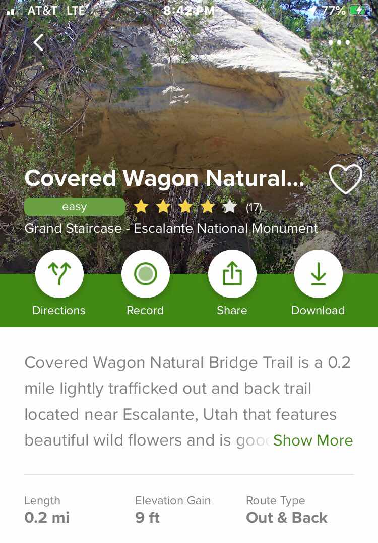
(AllTrails app screen capture)

There is another obscure location to check out in the Grand Staircase Escalante in addition to the Cedar Wash Arch I wrote about the other day:

The covered Wagon Natural Bridge is on the same road as Cedar Wash Arch a mile or so down the road.

Cedar awash Arch is one such place.  I found it on the AllTrails App and not the handout from the BLM about The Grand Staircase Escalante.  

Like the other location, the road getting there is best with a high clearance 4x4 although 2 wheel drive when the road is dry is possible.  Also, there is also only parking for a couple vehicles and why it’s probably not advertised by the BLM


It’s only .2 mile down the hill from the parking spot to the natural bridge.


A walk up strewn looking back.


A little further up strewn is this interesting cave carved out by the stream water when it flows.

Check out both the arch and cave when you go

Not an exciting hike, but the Covered Wagon Natural Bridge and the Cedar Wash Arch combined make a good half day excursion.

Happy hiking and touring.

Brent

macaloney@hotmail.com

Cedar Wash Arch - Grand Staircase Escalante


(AllTrails app screen capture)

I’ve been to the Grand Staircase Escalante a number of times an I thought I’ve seen everything close to Escalante and Hole-In-The-Rock Road, but I was surprised to find a few places lightly advertised as a site to see.

Cedar Wash Arch is one such place.  I found it on the AllTrails App and not the handout from the BLM about The Grand Staircase Escalante.  

The road getting there is best with a high clearance 4x4 although 2 wheel drive when the road is dry is possible.  

There is also only parking for a couple vehicles at the trailhead and why it’s probably not advertised by the BLM


There are no signs or directions on how to find Cedar Wash Arch.  I followed, or should I say, I tried following g the trail on AllTrails, but after awhile the trail was gone, I suspect from erosion.  


Heading back to the beginning of the trail the arch is visible looking southeast along the canyon rim.


Walking the rim towards the arch and then past it, I was able to get the photo above.


My AllTrails hike is above.  

The trail listed on AllTrails takes you down into the canyon, but that isn’t necessary, and not really possible as trail is gone..  The arch is in the area where I colored the map orange.

Looking at the map above look to the right.  This is the best viewing point and only a short distance down the cart road shown by from where I parked (black dot) following the dotted line.  All that other walking was a waste of time and energy.

It was a nice visit but bring your 4x4 if the road is wet and also enjoy the canyon view from the rim.

Brent

macaloney@hotmail.com


Monday, April 6, 2020

Milk From Powder


Way back when I first started stocking up groceries in preparation for pandemic isolation, I anticipated not being able to get milk or running out while secluded in the desert.

I bought dried milk, way back then.  Well, my anticipation of a problem came true in small town shopping in Utah.  I went to the store to buy supplies and there was no milk.  I came back to camp and made my first quart of milk, as seen in the picture above.

I used my graduated Nalgene bottle, filling it with water and added the milk powder.


After mixing the powered milk in the Nalgene bottle I transferred it to the repurposed quart milk bottle, that was now empty.  

I use milk primarily for my morning cereal and I was good for the next few days, and the taste was fine.

Brent

macaloney@hotmail.com

Sunday, April 5, 2020

Grosvenor Arch - Cottonwood Canyon Road


I’ve mentioned how much dryer it is this year, leaving the roads more passable to explore where I wasn’t able to go in prior years.  One such road is Cottonwood Canyon Road  in Staircase Escalante in souther Utah.  

Last year we tried heading north on Cottonwood Canyon Road and the road was so wet slippery / muddy that we had to turn around.  This year we headed in from the north and had no problem at all with the dry road.  In fact my Prius could have driven this road, although a bit slower.

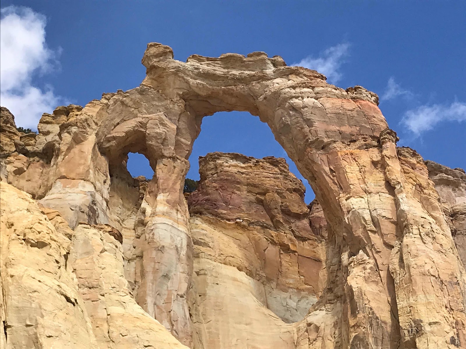
One of our stoops off the road was Grosvenor Arch, shown above.


It is a short road off Cottonwood Canyon Road to the trailhead, and the walk of a football field to the base of the arch.


Off to the left of Grosvenor Arch are other rock formations that are just as fun to check out as was the arch.

If you do get yo see the beautiful Cottonwood Canyon Road, stop to see Grosvenor Arch.

Now go back to the top picture and you may have missed that Grosvenor Arch is a double arch.

Brent

macaloney@hotmail.com

Saturday, April 4, 2020

Sautéed Shrimp With Noodles And Green Beans


This was a 2 pot dinner.  I made noodles and put the drained canned green beans in after the noodles were almost done.  I then drained the combination and set it off to the side.  

I then cooked the sautéed shrimp with some Mrs. Dash onion salt and graded parmesan cheese on top.  

For our group dinner I try to keep many dinners down to a simple bowel if possible.  I served the combined noodles and green beans and placed the shrimp on top.

It was very tasty and easy to cook on a one burner stove.

Each night I cook for us group of 3 all on a one burner stove.  

Happy one burner cooking.

Brent

macaloney@hotmail.com