On my list of places to visit for a few years is Sears Point. Tucked away 8 miles off I8 in AZ along the Gila River, it is a place that takes you back in time.

Getting to Sears point should be handled by higher clearance vehicles and preferably with all wheel drive or 4x4. The road in suffers from two sections of loose sand with hard packed sand underneath in a single vehicle wide section of road.
These sections of sand are a do not get off road area. I don’t recommend stopping on loose sand, but if you do, back up to an area where the ground is hard packed to let others pass. There are also sections of the road that are warm from rushing water that some vehicles will have to assess how best to get over them.
The picture above is from the end of the road at Sears Point where there is sand from flooding of the Gila River some times of years. Also you need Google maps or something that will show you what turns you need to make in the section of cross cross roads.
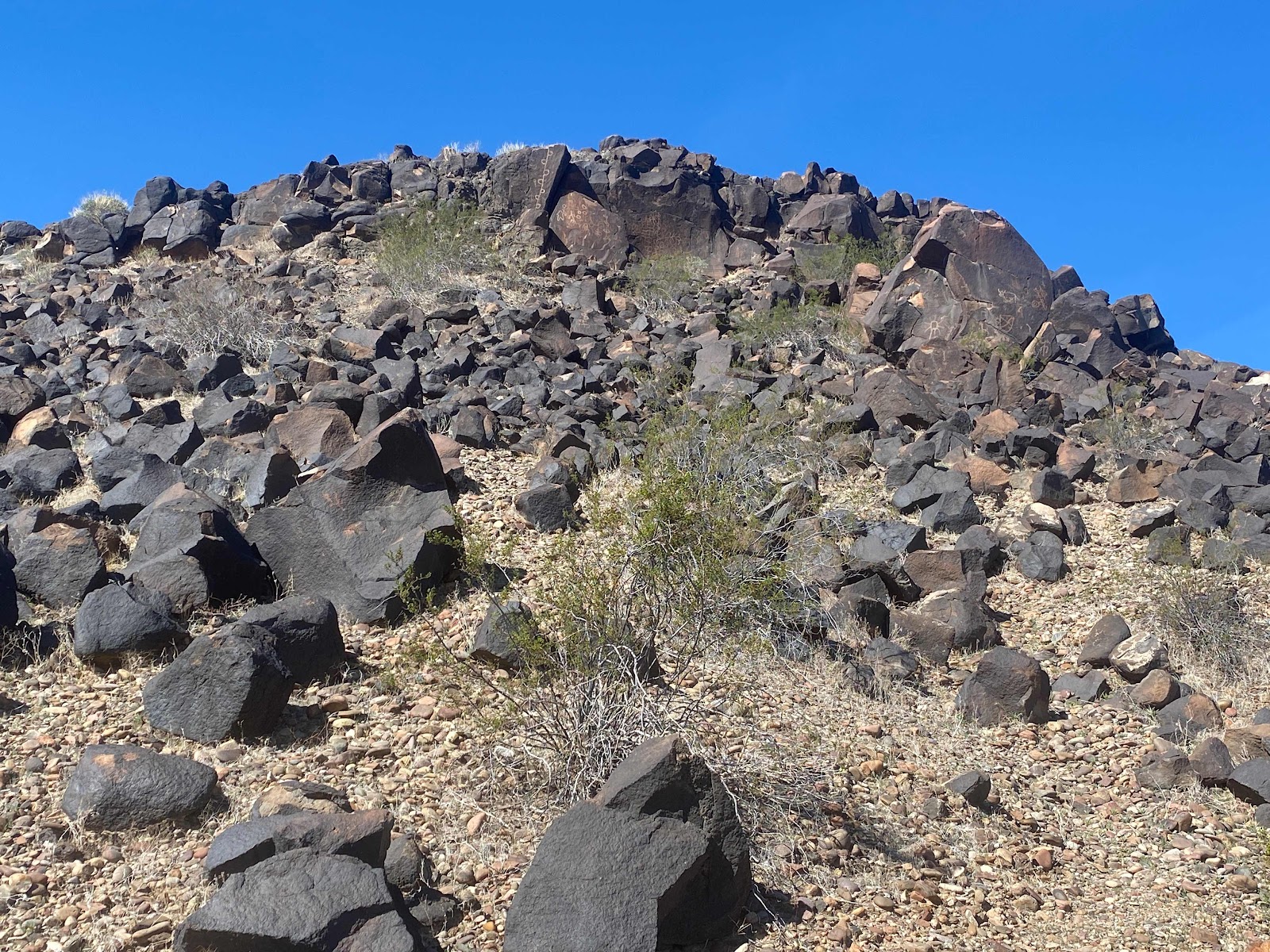
Once at Sears Point you see a hill of rocks. These rocks are hiding many petroglyphs and more modern inscriptions. There is no one way to find them other than do a lot of walking up, down and around this hill.
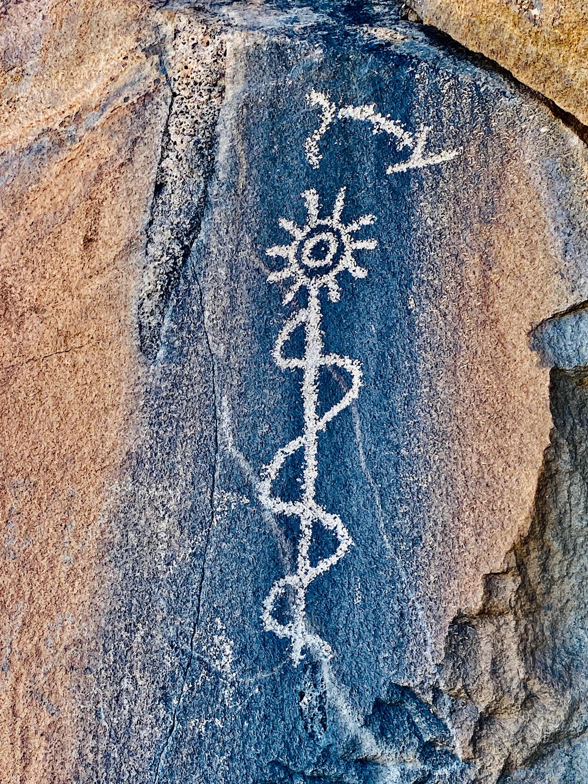
If you look carefully you will see what the ancients left behind to be discovered by us. The key is to be respectful and responsible not to damage or destroy them. Some are without our understanding like the picture above.

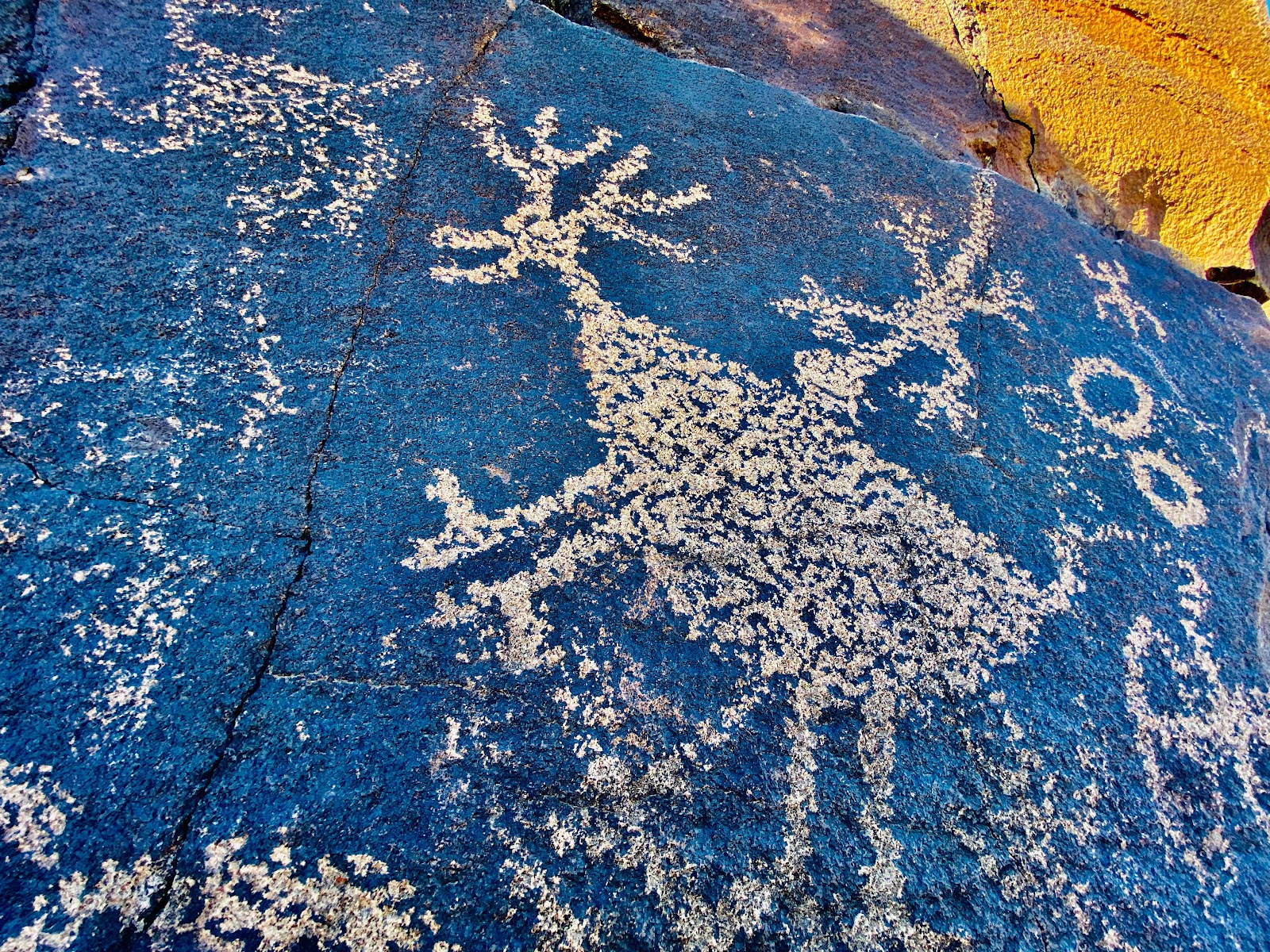
If your lucky and work at it you will see hundreds of petroglyphs. The picture above is more distinguishable as possibly a deer or horned sheep.
Then this petroglyph may tell a story.

Some panels have a lot going on, like this one above. The upper left almost looks like a modern day disc golf basket
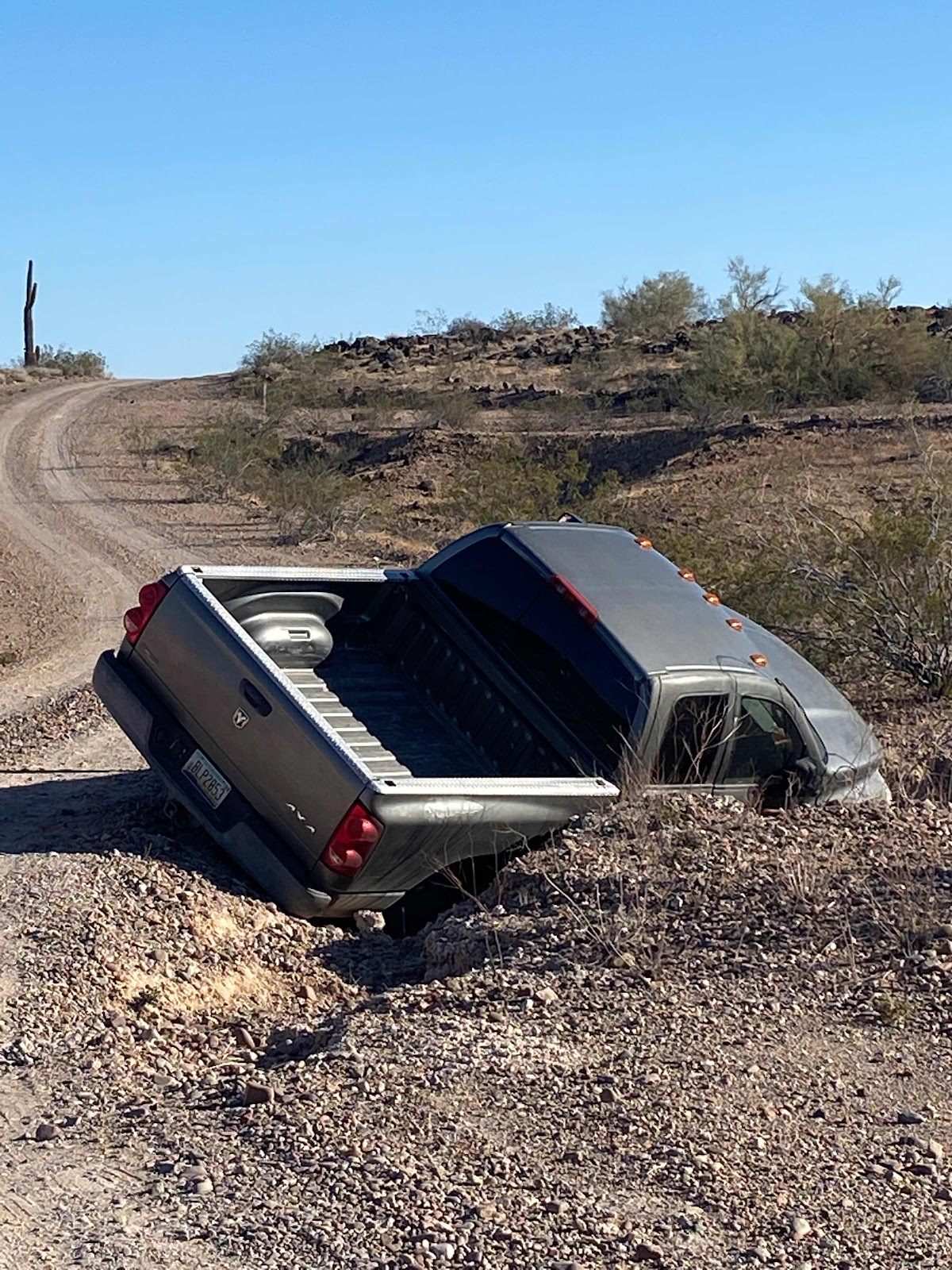
This truck had been there for a few days, with the driver going off the road one Friday after dark. This actually happened while my friend Roxy (see below) was there enjoying the area a few days before I arrived.
I met a neighbor who was looking for this truck, as it was his friends. His friend was reportedly drinking and after the accident he walked the nearby old Butterfield Stage route about 10 miles and didn’t remember where he left his truck.
I could not see how this truck would get out of this ditch without significant quality recovery work. Note it’s doubtful that a wrecker would make it past to get behind it.

(Picture - portion of Google image screen capture for section of Butterfield Stagecoach Route that passes Sears Point)
(Picture - portion of Google image screen capture for section of Butterfield Stagecoach Route that passes Sears Point)
I mentioned the Butterfield Stage Route that went past Sears Point. Upon my arrival at Sears Point a met a older man who has been doing research for years on the Butterfield Stage route and was there for more study. He also is trying to assist with the application to make Sears Point a National Monument. The location is historically significant as it was an important location for travelers. Spanish, ancients, Native Americans, and western expansion, used this as a route west.
Brent
macaloney@hotmail.com
PS. Here is a plug for my solo traveling friend of many years, Roxy

Facebook Adventure Nomad For Nature
Youtube Adventure Nomad For Nature
Im sure she will elaborate on her visit to Sears Point at some point in on of the media methods above.
No comments:
Post a Comment