Friday, February 28, 2020

Amboy Crater National Natural Landmark


I decided to explore a bit of the Mojave Desert and a drive on that portion of Route 66 that parallels I40 in California.

In the quite little town of Amboy, CA  is the Amboy Crater National Natural Landmark.

There is no sign warning of the turn.  You have to see the roadside sign above to know it’s here.

I opted for the hike to and up the cinder cones volcanic  crater .  4.1 miles mid-day in the sun is a little wearing but it wasn’t too hot.


In such a dry place and you see these flowers in bloom it calls you to stop and enjoy the beauty.


I made it up to the crater and inside it.


I hiked through the crater and up the craggy loose rock and dirt path to the rim.


Here is the view of the path through the desert back to the parking lot, from the rim.


Above is an all trails screen capture of hike.

At 4.1 miles round trip this is a good hike.  The hardest section was from the crater bottom to the rim as the loose rock makes it hard to get safe footing.  The portion up the side of the cinder cone was ok but it too is steep so some care is needed.


Above is an all trails screen capture of hike.

Above is the hike route and elevation profile.

If you ever happen to be in Amboy or just one of those people looking for nostalgia on RT66., stop to see the Amboy Crater and enjoy the moment.

Brent

macaloney@hotmail.com

Tuesday, February 25, 2020

Table Top Wilderness - Sonoran Desert National Monument


Note: all maps included are .pdf geo positioned maps loaded into an app called Avenza.  I’ll eventually review what map software we use and the advantages for exploring.

————————-/-

There was time for one more day for another Wilderness sightseeing trip while in Ajo, AZ and before I head to San Diego to visit family again for a week.

The purple drawn likes on the above map show the roads we traveled.

So, where is the Table Top Wilderness Area.  It is south of I8 between Gila Bend, AZ and Casa Grande, AZ.

Below is the Sonoran Desert National s Monument Map that I used in this blog.


The Table Top Wilderness will be the dark orange area on the bottom right of the map, above the salmon colored areas, that comprises Tohono O’Odham Indian Nation.


Above is an enlarged view of the area we toured in Joanne’s Jeep.

- We first drive to the Lava Flow North Trailhead.


When you enter the Sonoran Desert the BLM sign welcomes you

The road we traveled have not been maintained recently and are only accessible by high clearance 4x4.  Joanne’s Jeep is just the right vehicle for exploring.


The side road clearance is narrow from grown in thorn trees and cactus.


Before figuring out we need to close the windows this thorny beast broke off and cane into my window.  I’m glad I saw it before it got me.

- Then the Lava Flow West Trailhead

The scenery was not that spectacular compared to other areas but the roads were technically fun to figure out.

- Lastly the Lava Fliw a South Trailhead and up the road a bit further the Table Top Trailhead

But then we got to this old grading field and it was just spectacular to see and get out and take some photos.


as we headed out to the mountains in the distance we roads up in elevation and we got some nice views.


That is Tabke stop Mountain in the distance


We gained enough elevation to get into a growth of the Saguaros. 


In the map above there is a sawtooth red line connected by dotted red line.  This area requires a permit to access.  We did not enter that area.  Possibly a future trip.

All the wilderness areas are fun to see and visit but some areas have less natural beauty.

Finding that spring flowered cover field was worth the whole trip to me.

Brent

macaloney@hotmail.com

Wednesday, February 19, 2020

El Camino Del Diablo Road and Trail - Cabeza Prieta Wilderness

Please see post with basic information about the Cabreza Prieta Wilderness that explains the wilderness and permits you must have to enter the area.


Also see other related post for the other wilderness area called Charlie Bell Pass in Cabreza Prieta Wilderness


Below is the website for the wilderness area.

The El Camino Del Diablo Road and Trail is in the same brochure as the Charle Bell area.


Photo of wilderness area brochure 

——————-

- The El Camino Del Diablo Road and Trail is the larger area to tour and Boondocking is allowed with conditions.

See yellow line below - this is the first of two trips into this larger wilderness.  Today was a long day in and out on the same road.  This totaled a 144 mile day.

Photo of wilderness area brochure 

My Vandwelling friend Joanne got a Jeep for wilderness exploring.  Without her wanting to explore, and invite me, I would not be doing all of this trip.


Even with my 4x4 truck camper Joanne can go places I can’t.  Especially deep groves washes and the Jeep’s short wheelbase she can handle them with ease.  My truck with longer wheelbase and longer angle of approach and departure would  jam the nose in the ditch or hang up the rear end coming out and I would be stuck.

There are four of us that have done these wilderness travels, Joanne the driver, Cafe Joanne’s standard poodle, Susan, and me.

There is a lot of planning and checklists to prepare for and accomplish these travels.  We are al in on being safe and having the right permits, and supplies.

We are a team.

Now to the yellow trip above:

You drive through any miles of BLM land and Organ Pipe Cactus NP to get from Ajo, AZ to the entrance of the wilderness.  This section of road is in general in good shape and I could have gone now my Prius this far, although I would have had to use caution in a few areas.
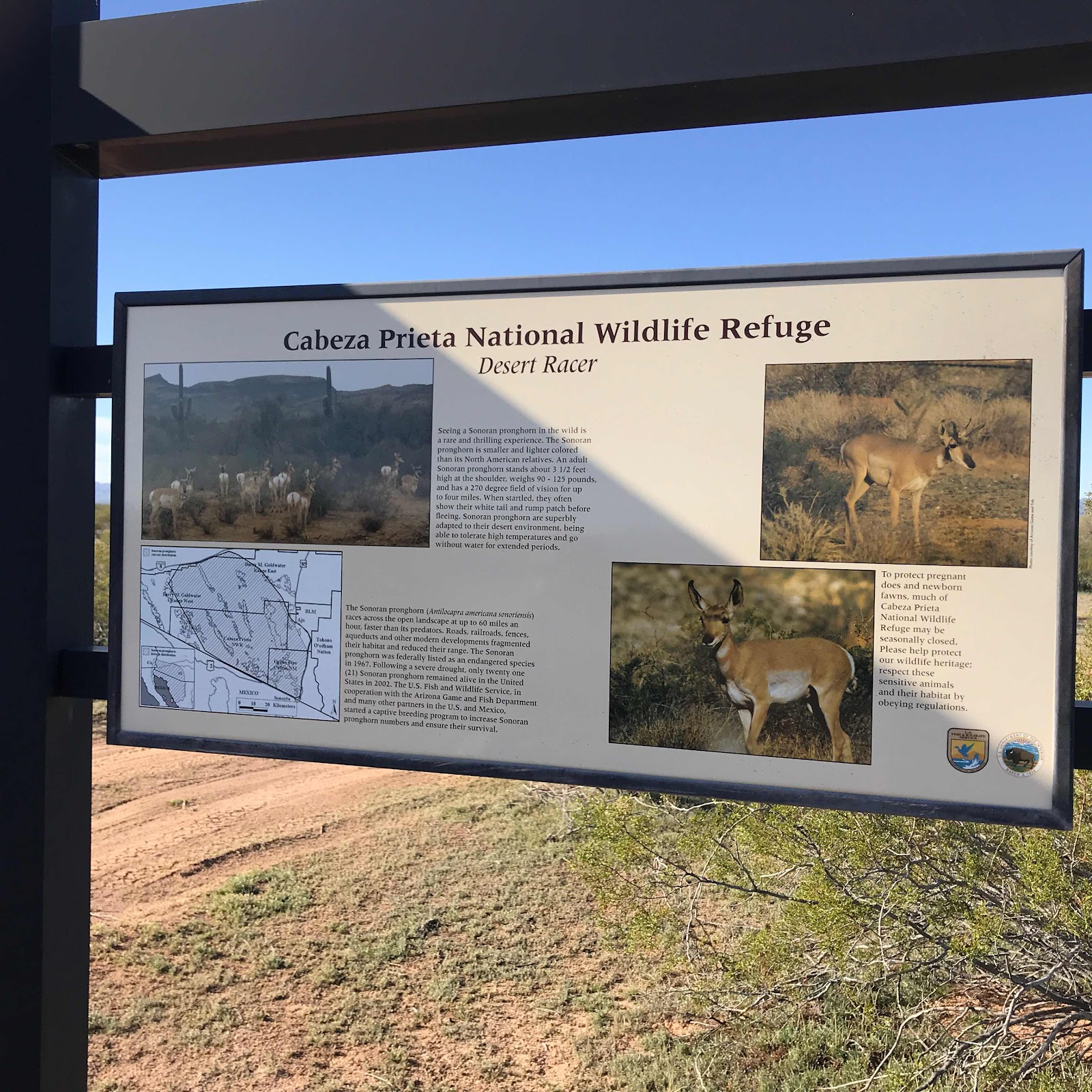


When we arrived at these signs at the entrance of the wilderness there is a process to log in that you are in the wilderness.


Above is the map of the wilderness area.  The road from Ajo continues Southwest until we are just a few mikes from the Mexican border.  We picked up Mexican cell service on our AT&T phones in places.
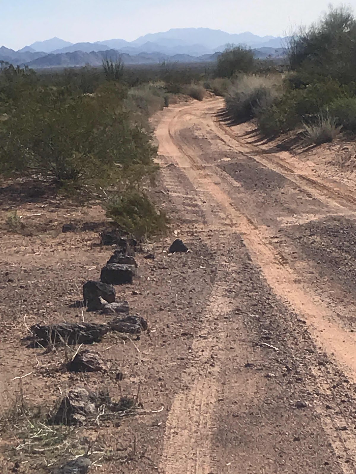


The sand hazard while we were there was minimal as most sand was pushed to sides, leaving the tire tracks packed sand.  These conditions can change.

We were stopped by Wilderness law enforcement to check our permits today.


Above was all mud a few days ago when it rained heavily here while we were in Organ Pipe Cactus NP.  We deliberately dragged our feet coming here wanting spots like this to dry up as much as possible.

Some ruts were 12 “ deep but Joanne did a great job riding the ridges and not slipping in.

After this dry lake bed mud flat the road became very rocky in places wher lava flows exist.


Above is one of two remote Border Patrol Stations on our route this day.  Even though you sign the waiver of liability to enter the wilderness to take full responsibility of seeking your own help, there are wilderness law enforcement patrols and Border Patrols that will be primarily on the roads.  Also even through most of the travels are not covered by cell service if you have AT&T may get some Mexican cell service along the border for a few miles.  

You are also responsible to get your vehicle out no matter the cost of recovery.
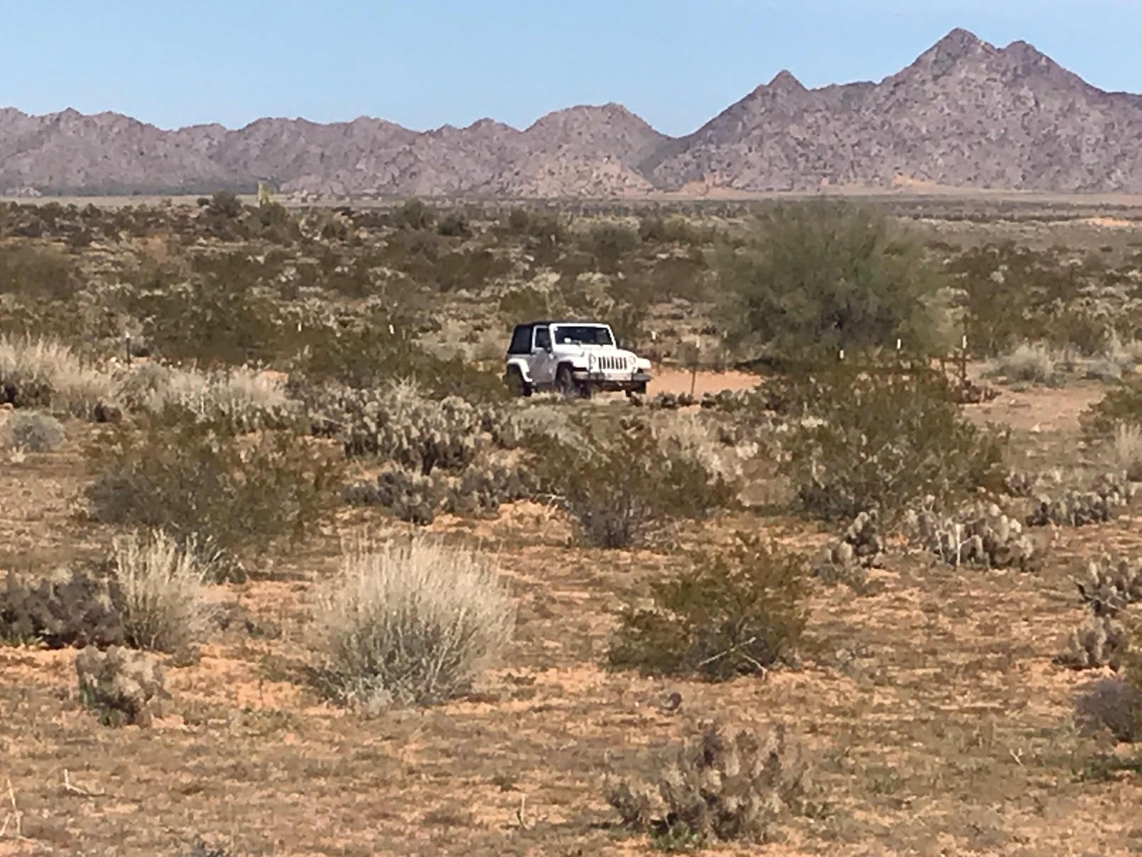


Here is Joanne’s Jeep as we look for grave site as this was a cross country route during the gold rush and not everyone made it.

——————-

The third day of wilderness travel depicted below in red travel, was longer than the first, taking about 8 hours of travel.


Photo of wilderness area brochure 

We left Ajo for Gila Bend, then West in I8 to the town of Tacna on I8 and head across the the Barry Goldwater Range that requires a separate permit applied for online


To get to the remaining sections of the Cabreza Prieta and not repeat the previous days travel we decided to enter this way through the Barry Goldwater Range and exist back onto I8 to Ajo.


There are similar signs for the Barry Goldwater Range with warning and conditions of a permit.

I should tell you both permits require viewing an online video to learn that the Cabreza Prieta was a WW2 practice bombing range and live ordnance should be expected if you het off the road to hike.  No touching as there is a risk of detonation.

Barry Goldwater Range’s video informs us that it is still used by the Marines for live firing of ammunition, so this access may be closed for live operations

The drive through Barry Goldwater Range was flat and miles of sand and very uninteresting.  The cmsand in the tire ruts is packed but it’s easy to get pulled into the center and side ridges of deeper sand.  This section is definitely high clearance and 4x4.


We finally got to Cabreza Prieta border we had to check in again as we did yesterday.  The scenery finally became more interesting.coming into an area with rocks and hills.


We were stopped by two wilderness law enforcement officers at two locations.  They both checked our permits.


We headed to where we turned around yesterday and continued west back out of the wilderness and north again to I8 and back to Ajo.

There were two dry camping areas on this route and one on the route yesterday, although Boondocking is allowed with restrictions.

The toughest part of this drive is through Christmas Tree Pass where the road is as narrow and rocky, as the width of a large pickup truck.  I would be concerned trying g to get my truck camper through.  

The pass is on a blind corner to make this even harder.

It’s amazing how remote you can be and still be in the USA.

It’s worth a visit to these remote areas as they are our public land.  Don’t pass up places like this for just the popular named places.

Brent

macaloney@hotspot.com


Charlie Bell Pass - Cabeza Prieta Wilderness

Please see post with basic information about the Cabreza Prieta Wilderness that explains the wilderness and permits you must have to enter the Charlie Bell Pass area.


Although it may say you need two copies of the permit to enter Cabeza Prieta Wilderness, we got our permits at the Visitor Center and were only given one. When asked we were told we only needed one and if you go hike leave the permits on the dashboard.

Today we headed out in Joanne’s Jeep to see Charlie Bell Pass.

Below I captured the portion of the visitor center map of where we were going.


Photo of wilderness area brochure that I altered with markings

The Town of Ajo is to the right and the yellow (right to left) is the route we took.  Please check with visitor center for roads that are open.

The red X is the end of the drivable road as there is a gate. From where you park your car you hike on the washout dirt road into the wilderness.


Most of the road into the wilderness is packed sand but the section as you climb to the saddle of the pass the sand is mostly washed away and left exposed rocks, that made for bumpy ride for about the last 1/2 miles.

You don’t need a 4x4 Jeep to get here, but you need higher clearance.  This is not prius territory!


At the pass is where you park near this remote emergency phone.


On the way out to the pass there was plenty of cactus and other plants, but at the pass only a few Ocotillos. 


over the pass and down from the hills the chola Cactus provide a nice reflection of the afternoon sun.


Looking the other way I saw this ocotillo with beautiful red leaves. It made for a stunning foreground for a picture of the hills too.

We didn’t get started early enough to hike too far this day, as there are some bolders with petroglyphs about 1.5 miles from the trailhead.

Brent

macaloney@hotspot.com

Tuesday, February 18, 2020

Cabeza Prieta National Wildlife Refuge


Continuing with my travel goal this year to look at new places, my friend Joanne suggested a trip to friend Susan and I that we visit the Cabeza Prieta Wilderness visitor center in Ajo, AZ where we were now staying after a few days in Organ Pipe Cactus NP

We arrived at the visitor center and were met by the Visitor Center host who explained that there were two general wilderness areas to visit, but if we wanted to go we would need to get a permit good for 1 year ending June 30th.  Then we were told that before we could get our permit we would need to watch a video on the rules.

The permit mostly contains what you can and can not do, as well as your personal accountability while in the wilderness.  Lastly, the permit wages the government’s liability and ensure you understand by going you assume all liability.

Ah heck, we filled out the free permit anyway.

Below is the website for the wilderness area.

The following is a brief description of the wilderness area:


Above is a screen capture from the website webpage)

As I stated above, If you go you must have a permit!!!!!

https://www.fws.gov/refuge/Cabeza_Prieta/visit/permits.html

Visitor Permits

To obtain an Access Permit for:
Cabeza Prieta National Wildlife Refuge (CPNWR)
Barry Goldwater Range -West
Barry Goldwater Range – East (Area B)
Sonoran Desert National Monument – Area A

GO TO: https://luke.isportsman.net  


  • Open the drop down labeled "Account Info and Registration" and select "New User Registration"
  • You will be required to watch the safety video and agree to the hold harmless agreement, after which you'll be able to obtain your access permit.
  • Print two copies of your permit so that you have one to keep with you and one for your vehicle.
  • The permit is good through June 30, 2020.
  • While you can print off the appropriate land management map from the site, hardcopy maps will be available at the Cabeza Prieta National Wildlife Refuge Visitor Center.

In addition to the Hold Harmless Agreement you agreed to online, you must be familiar with local rules and regulations specific to each land management jurisdiction you access. These are located on the back of each agency's map.


The CPNWR Office is open Monday through Friday (except for holidays) 
8:00 am - 4:00 pm. Phone: 520-387-6483

Map and Additional Rules Specific for Cabeza Prieta National Wildlife Refuge (right click to download or print)

Special Use Permits
These permits enable the public to engage in legitimate wildlife-related activities and ensure that such activities are carried out in a manner that safeguards wildlife. Additionally, some permits promote conservation efforts by authorizing scientific inventories and research.

At the Cabeza Prieta National Wildlife Refuge, wildlife comes first. For this reason, Special Use Permits are required in order to conduct the following types of activities: 

  • Commercial activities
  • Hunting 
  • Stock animal usage 
  • Vehicle groups of five or more 
  • Research 

Visit the National Wildlife Refuge System web site for more information on Special Use Permits.  Additional information can be found at How to Obtain a PermitFAQs/Facts or Application Forms

—————————-

I stated above that there were two general areas in the wilderness.

1. Charlie Bell Pass
2. El Camino Del Diablo Road and Trail


Photo of wilderness area brochure 

The following map depicts the total wilderness area.

- The Charlie Bell Pass is the smaller circled area to the right on the map.

- The El Camino Del Diablo Road and Trail is the larger circled area to the bottom of the map.


Photo of wilderness area brochure 

I will be reviewing both sections of the wilderness area in separate blogs.

I can tell you that I was amazed with the unspoiled vastness of the area where science from outside influences don’t exist, except for a passing airplane.

It was certainly worth the trip.

Check out my visits to both areas.

Brent

macaloney@hotspot.com


Monday, February 17, 2020

A Look At A Segment Of The Border Wall With Mexico - Old / New

We all know about the President’s plan to build/replace a boarder wall with Mexico.  We know that Mexico has not paid for it as the President had promised. 

I have heard about the Texans along the border wall that are fighting the government about giving up their land for a border wall.

It wasn’t until I came to Organ Pipe Cactus National Park and went to Lukeville, AZ to see the progress on the wall there that I learned of the controversy here about native burial grounds on a hill adjacent the wall construction.  The wall has an affect in many, but the native Americans here, who were here before countries are also being affected by the building of the wall, as the contractor is blasting on their burial site.

See the following link for more details.

Here is a screen capture of the articles cover page.


Here is a map of the location.

Above - Google maps screen capture.

Note: 
- Red pin drop is hill being blasted.
- Blue pin drop near top of picture is the camping area at Organ a Pipe Cactus National Park

I visited the construction site and took the following pictures.


Above is the new wall on flat ground and the burial hill in the article you can see rise up in the distance.  

I could hear what I believed to be the blasting while in Ajo, AZ, some 45 miles away.


I was here last year and the old fence to the right of the new talk fence is just metal beams with Velcro’s member that you can step over.

The white building you see is in Mecico.


I was curious what these special wall panels are.  They are placed every so often along the new wall. 


Above is a better picture of the old wall, or should I say fence.  This will soon. E replaced with the much larger wall.

I know I could step over that fence, but the new wall can be climbed and Horton over too.

Here is a news article with a video with 2 people climbing one side and over the other.


Above is a google search screen capture showing a picture of the video where two people climb over the new border wall.

I like to check stories for truthfulness, so I went to Snopes.com and they said have the following.


Above is from a Google search of snopes.com to validate the video.  

Brent

macaloney@hotmail.com