Sunday, March 18, 2018

Where In The World Is Brent?


Folks,  

I have done a terrible job of posting on what I have been doing and seeing because of poor cell service..  After leaving San Diego and being sick with a bad cold that lingered, I moved to Lone Rock Campground just into Utah from Page, AZ.

I was there a few days, but at Lone Rock Campground I had poor cell service (Off Network) and couldn’t work on blogging as I need to upload my pictures and work on blog posts.  I could only do this in Page at McDonalds or the Page Library.

Anyway, my WiFi time also gets split to download podcasts to stay up with what is going on in the world.

The bottom line is that for AT&T subscribers you don’t get AT&T often in southern Utah and when you do it could be anything from Edge, 3G, 4G, or LTE.  I’ve had all of them and I can say that there is no guarantee that any will work beyond voice and text.  


Where I’ve been, most of the time I have no signal or Off Network.  What you get off network is whatever AT&T negotiated with that carrier.  Usually, voice and text only!  That means that apps don’t work.  If you get data consider yourself lucky.

So where have I been?  Mostly all over southeast Utah, as indicated with the picture of the map above.

Towns I’ve been to that you may want to check on a map.

Bullfrog, UT
Mexican Hat, UT
Bluff, UT
Natural Bridges National Monument 
Bears Ears National Monument 
Hanksville, UT
Caineville, UT
Fruita, UT
Valley of the Gods, UT
Hite, UT
Kane Gulch, UT
Fry Canyon, UT
Noton, UT
Ticaboo, UT
White Mesa, UT
Blanding, UT
Hovenweep National Monument 

Many of these places are out of the way on dirt roads.

Have fun looking them up while I continue to head out for about another week of discovery of southeast Utah so I can add to this list.

Specific location posts will have to come with time once I am regularly with cell service.

I’m getting good use out of my high clearance Tacoma with camper in these remote places.

Brent

macaloney@hotmail.com


Sunday, March 11, 2018

Rainbow Bridge National Monument


It’s hard to top my 2017 Travels with a hike into Havasu Falls / Grand Canyon or The Wave in Escalante National Monument.  This year I have opted for one of the most difficult National Monuments to get to.

Rainbow Bridge National Monument on Lake Powell is unique as most people go to see it by tour boat.  The Colorado River in Page, AZ is held back by the Glen Canyon Dam, forming Lake Powell.

About 50 miles up stream on a tributary from Navajo Mountain, Rainbow Bridge was discovered in 1909.  All the explorers prior had missed it on their expeditions down stream.  


Rumors of a great stone arch finally met the right people and they found Rainbow Bridge.  It’s a Bridge and Arch but a Bridge because it was undercut by water flowing through it.


Rainbow Bridge is exceptionally large and well formed.  It offers a view with over 10,000 foot snow covered Navajo Mountain in the backdrop as you look up stream.


The National Park Service oversees the management of Glen Canyon Resorts and Marina’s where I arrive at 7:30 am for an 8:00 departure.

The boat trip is about 6 hours long and cost me $117.00 after AAA discount, so it’s not cheap.  The other way to go is to rent your own boat and pilot it yourself the 50 some odd miles there and back, or get permits from the Navajo Nation to hike in.  Both come at a cost too.


The boat we were on had an open top and closed bottom.  I opted for the lower knowing how cold it would be on top with 20 knot wind.  

Eventually those with the hardy thoughts came to join the warmer area below but many ended up standing due to seatscalready being taken.


The route up the Colorado River is scenic at every turn.  There is a narration headset that you can listen to information about the buttes and history.


There are plenty of places to enjoy along the way and I can see how having or renting a houseboat on the lake That goes for over 100 miles can be a fun adventure when you consider that there is over a thousand miles of shoreline to explore.


Our boat operator tucked into this arch.  She explained it was popular in the summer sun to stay cool.


We arrived at our destination in about 2.5 hours by boat.  We have 1.5 hours to tour Rainbow Bridge up the approximate 1 mile easy path.


Above is my first glympse of the Arch as I make my way along the trail.


It was a cloudy morning but it brightened significantly before the heavier clouds of the evening and impending rain that is coming.

I got the reflection of Navajo Mountain in the foreground water.


Being nearly there a zoom in above to Rainbow Bridge gives highlights of the arch against the snow in Navajo Mountain.


The phots facing South picked up the milky sky that was reflecting to wash out the arch at the top.


Contrast the above photo to the one below.  The above picture was shot into the bright sky to the South.  Our guide had us climb around (not ever under) the arch to take more photos.  Not picture below with the sun to my back.


Why not walk under the arch?

The Navajo Nation requests that we respect that they believe that the land under is sacred.  Everyone complied with the signage, and it’s actually easier to use the path than try to make your own trail.


On the back side (South) of the bridge are two plaques to commorate the two native Americans who assisted in finding Rainbow Brodge.


There are many places I still have not seen on my travels but Rainbow Bridge NM is another one that I’ve completed.

Brent

macaloney@hotmail.com

Tuesday, March 6, 2018

Devils Golf Course - Death Valley National Park


I’ve been to Death Valley a few time during my yearly travels.  This year I obtained a whole new appreciation for this beautiful National Park.


Take the Devils Golf Course for example.

What looks like ruggard baron land, is actually a thing of science.  How the salts left over from leaching and drying leaves deposits that are as unique as anything you will see anywhere.


These deposits provided difficulties for early settlers to pass over.  If it wasn’t for the road to the middle of the salt bed to view I couldn’t have walked through it without twisting an ancle.


What amazes me is that the salt crystals have been moving and forming this way for thousands of years.

We are amazed by old redwood trees for example but sometimes we just don’t think how amazing natural things like these salt formations really are.

Brent

macaloney@hotmail.com

Seat Notches?


I visit a lot of McDonald’s in my travels to get iced tea and to utilize WiFi.  Yes, that can be hundreds of McDonald’s during my 4 months of travels.

This McDonald’s in the picture above goes down as the first to have seat notches.

What are seat notches?

I sat drinking my iced tea pondering this question for a few minutes and decided it was for purses or strapped bags to keep them from sliding off the back of the chair.

May we see notches on seatbacks in other restaurants in the future?  I hope so as it seems like a good idea.

Brent

macaloney@hotmail.com


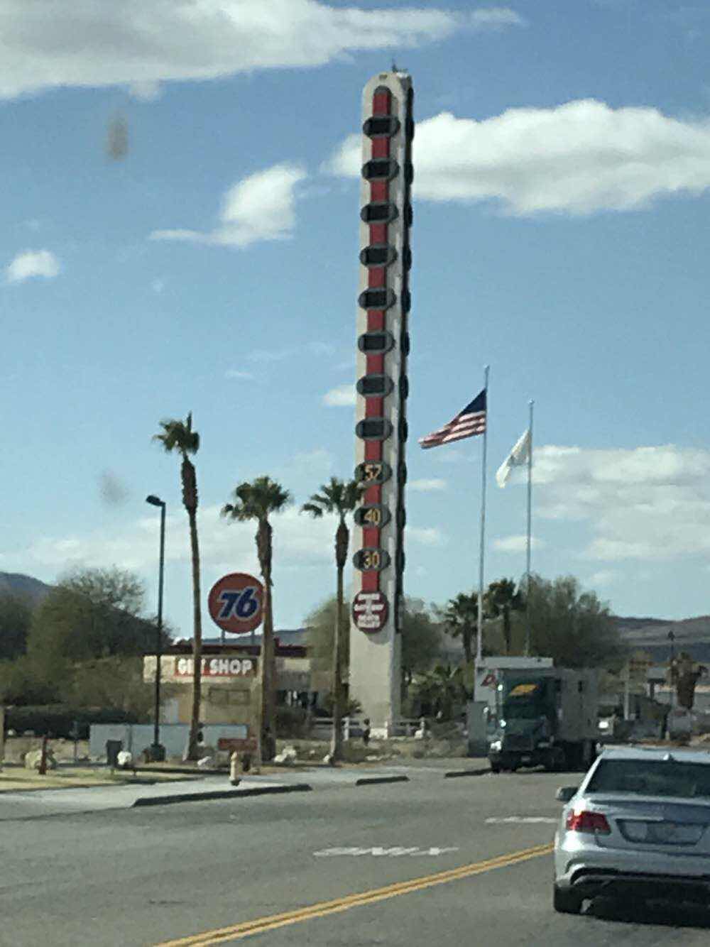
The World’s Tallest Thermometer


While planning my recent visit to Death Valley National Park, I chose the way in from the South leaving I40 in the small town of Baker, California.

As noted in the Google Map snapshot above I am told this is the town of the largest Thermometer in the world.


As I drove into town from the east, I could make out the pole that I thought was the thermometer in the distance.


As I got closer I could see the readout and it said 57 degrees.

I have a few blog followers that like me pointing oddities.  I don’t search for them but when it’s presented to me I’m willing to add it.

It does classify as an oddity to me but I didn’t feel the wow factor.  Possibly you will when you see it some day.

Brent

macaloney@hotmail.com


Ubehebe Crater - Death Valley National Park


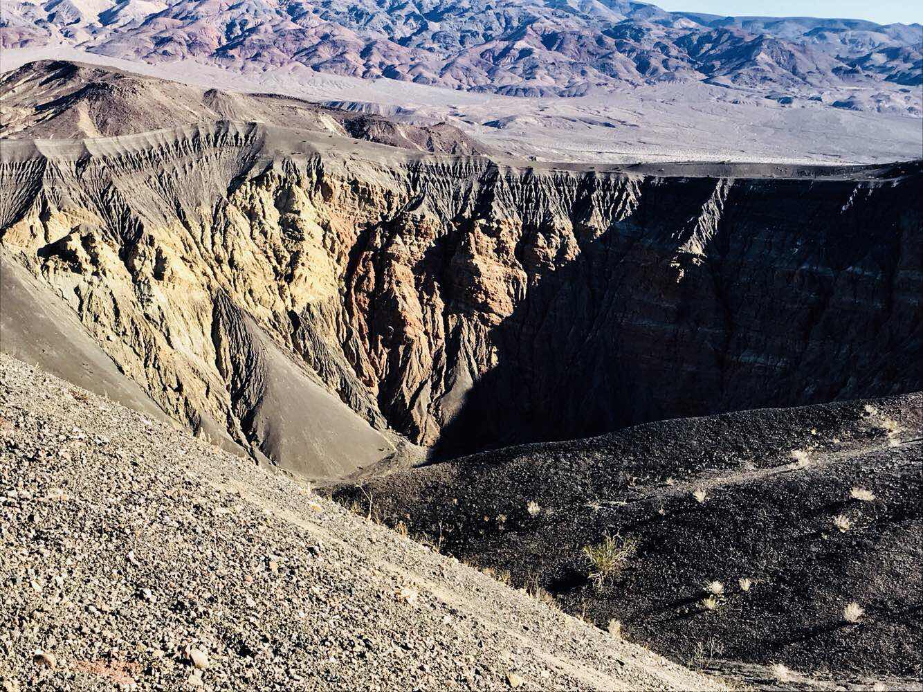
The most significant find in Death Valley this year was seeing the Ubehebe Crater.

Why after all these years of visiting Death Valley do I know know of and get to visit Ubehebe Crater?


The last few years I’ve wanted to explore the northern half of this vast National Park, but each year the sign to the road headed north says Scotty’s Castle is closed and campground is open.  Not wanting to go to this campground left me not making the 50 mile drive up to where the road is closed from being washed away, and yes the 50 mile drive back.  That’s 100 miles of driving and gas to see an open campground?  Sign didn’t list Ubehebe Crater or that it was available to be seen.

Look at the portion of the map above and That is the Northern half of Death Valley.  That is the road to Scotty’s Castle that is closed.  At the left of the end is the crater.

I was adventurous this year and decided I won’t drivevthe 100 mile round trip to the end of the road.  I then took the side road off from where the road is closed and what do I find, but the most beautiful feature in Death Valley.


From the parking lot you park at the rim of this crater in the  above picture.


You can hike around the circumference of the Crater at the parking lot or hike into the caldron.   I started up the high side of the crater and the view of the smaller craters was gorgeous.


You can see that people have hiked the rim of this crater too.  I have to say that it’s steep around the edges.  


I made it up to this spot where there were professional photographers poised for the right light I guess.

For me was this dead tree on the rim of One crater looking down at another.  


Here is a look back to the parking lot on the far side of the first crater.  I was told it was just over 3 miles around.  I was also warned that a climb insisted to the bottom was a slug.  I gather it meant tough walking.

The rim is steep and although there is an established trail if you are not careful and slide off it could be a bad day.

I stayed away from bad days but sticking to places I couldn’t get myself in trouble with.

A great reason to camp way out at the campground nearby is to hike this area around the craters and the adjacent hills to get a more aerial view of them.

The folks at the Death Valley visitor center don’t have anything to encourage people to visit this area and with no sign on a closed dead end road, I can see how I missed it in years past.

If you are going to be in Death Valley and are looking to see the sites, don’t miss out on one of the greatest sites in the Valley.  Just think this is a young crater at only about 2000 years old, not some worn down one.

Brent

macaloney@hotmail.com

Saturday, March 3, 2018

Sick On The Road

(Google Image)

I usually get sick on the road at least once during my travels.  Usually it’s a 24 hour thing, but I had pain in my side one year and I went to clinic.  

Well, it’s happened this year.  It started out like a cold on Wednesday.  Thursday I felt so drained that rather than play disc golf I just climbed in my camper and slept 3 hours.  Then I arrived at CA son’s house and slept two more hours.  By evening I had the chills.

On Friday morning I was supposed to go to my granddaughters class for family day but standing made me feel nauseous and a little off balance.  I was going to have my Tacoma serviced too but I stayed in bed for the day, feeling a bit better to go out for dinner with family

Overnight Friday to Saturday I could tell my body temperature had corrected itself.  


Feeling much better but not perfect I got up early and arrived at Mossy Toyota for my truck servicing.  

I’m glad I didn’t get the flu on this or any of my travels.  If I had it would be miserable.  It was nice to crash at my son’s house but that isn’t always possible.  I do have some friends scattered around the southwest that I could contact if I did need help.

It’s good to have vandweller friends that look out for each other.

Now you know why I haven’t posted lately.

Brent

macaloney@hotmail.com